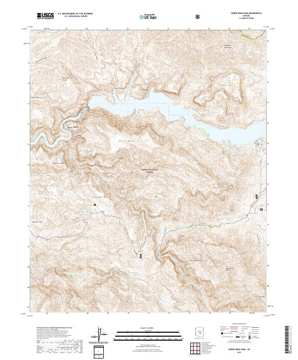
2021 Map of Horse Mesa Dam
USGS Topo · Published 2021About this map
Horse Mesa Dam serves as the central focal point of this arid landscape, where the Salt River is impounded to form the winding waters of Apache Lake. Set within the Tonto National Forest, the topography is defined by dramatic elevation changes and named rock formations like the Walls of Bronze and Painted Cliffs. Historically significant routes, most notably the Apache Trl, traverse the complex network of canyons and mesas, following the natural contours of the Salt River Valley. Remote water sources, including Hells Hole Spring and O'Connell Spring, suggest the critical importance of reliable water in this desert environment. The map details a region where infrastructure and natural barriers meet, from the depths of Fish Creek Canyon to the heights of Fish Creek Peak.
Find a feature on this map
46 named features on this map. Tap any name to fly to it.
Don’t see what you’re looking for? This feature index may not catch every label — zoom into the map to look around manually.
Map Details
Editions of this 2021 Horse Mesa Dam Map
This is the sole edition of this map. No revisions or reprints were ever made.
Other maps of this area

1900 · Florence
USGS Topo · 1:125,000

1902 · Florence
USGS Topo · 1:125,000

1907 · Roosevelt
USGS Topo · 1:125,000

1909 · Four Peaks
USGS Topo · 1:125,000

1912 · Roosevelt
USGS Topo · 1:125,000

1948 · Superior
USGS Topo · 1:62,500

1948 · Iron Mountain
USGS Topo · 1:24,000

1949 · Iron Mountain
USGS Topo · 1:24,000

1954 · Mesa
USGS Topo · 1:250,000

1956 · Goldfield
USGS Topo · 1:24,000