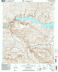
2004 Map of Horse Mesa Dam
USGS Topo · Published 2007About this map
Apache Lake (Salt River) and the towering Painted Cliffs define this remote stretch of the Salt River Canyon within the Tonto National Forest. The map centers on the massive Horse Mesa Dam, showing its spillways and the cluster of Salt River Project Housing that served the dam's operation. This era of the landscape reflects a balance between utility and preservation, with the Four Peaks Wilderness to the north and the Superstition Wilderness to the south.
Find a feature on this map
60 named features on this map. Tap any name to fly to it.
Don’t see what you’re looking for? This feature index may not catch every label — zoom into the map to look around manually.
Map Details
Editions of this 2004 Horse Mesa Dam Map
This is the sole edition of this map. No revisions or reprints were ever made.
Other maps of this area

1900 · Florence
USGS Topo · 1:125,000

1902 · Florence
USGS Topo · 1:125,000

1907 · Roosevelt
USGS Topo · 1:125,000

1909 · Four Peaks
USGS Topo · 1:125,000

1912 · Roosevelt
USGS Topo · 1:125,000

1948 · Superior
USGS Topo · 1:62,500

1948 · Iron Mountain
USGS Topo · 1:24,000

1949 · Iron Mountain
USGS Topo · 1:24,000

1954 · Mesa
USGS Topo · 1:250,000

1956 · Goldfield
USGS Topo · 1:24,000