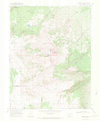
1967 Map of Horsefly Peak
USGS Topo · Published 1971About this map
Uncompahgre National Forest covers much of this high-elevation landscape, where the intersection of Ouray, Montrose, and San Miguel counties meets at a series of ridges and mesas. This mid-1960s survey documents a specialized ranching and water management network, evidenced by family-named landmarks like Hofmann Ranch and Phillips Camp. Water security for livestock is a defining characteristic of the terrain, with numerous improvements including Hofmann Reservoir, Horse Pasture Reservoir, and the Paxton Reservoir scattered across the drainages.
Find a feature on this map
48 named features on this map. Tap any name to fly to it.
Don’t see what you’re looking for? This feature index may not catch every label — zoom into the map to look around manually.
Map Details
Editions of this 1967 Horsefly Peak Map
4 editions found
Other maps of this area

1909 · Montrose
USGS Topo · 1:125,000

1911 · Montrose
USGS Topo · 1:125,000

1953 · Placerville
USGS Topo · 1:24,000

1956 · Montrose
USGS Topo · 1:250,000

1956 · Moab
USGS Topo · 1:250,000

1959 · Moab
USGS Topo · 1:250,000

1959 · Montrose
USGS Topo · 1:250,000

1960 · Montrose
USGS Topo · 1:250,000

1960 · Moab
USGS Topo · 1:250,000

1962 · Moab
USGS Topo · 1:250,000