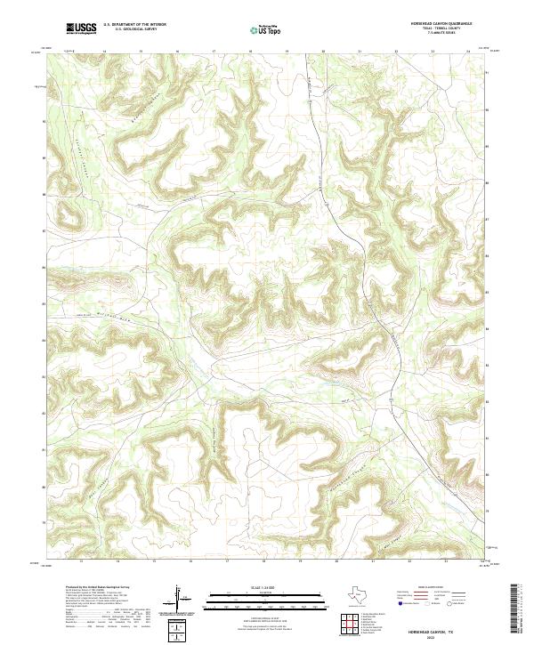
2022 Map of Horsehead Canyon
USGS Topo · Published 2022About this map
Independence Cr carves a critical path through this arid portion of Terrell County, serving as the primary drainage for a network of deeply etched landforms. The terrain is defined by a series of significant canyons and draws, including the prominent Bearfoot Canyon in the north and Horsehead Canyon to the south. This remote landscape is accessed by a sparse network of ranch roads, most notably Ranch Rd 1217, which winds through the eastern portion of the quadrangle. The naming of features like Oil Well Canyon and Surveyor Canyon suggests a history of resource exploration and land division in this West Texas environment. Local ranching access is further detailed by unpaved routes such as Korn Rd and Davenport Rd, which link the high plateaus between Mitchell Draw and Deer Canyon.
Find a feature on this map
13 named features on this map. Tap any name to fly to it.
Don’t see what you’re looking for? This feature index may not catch every label — zoom into the map to look around manually.
Map Details
Editions of this 2022 Horsehead Canyon Map
This is the sole edition of this map. No revisions or reprints were ever made.
Other maps of this area

1928 · Sanderson
USGS Topo · 1:125,000

1929 · Sheffield
USGS Topo · 1:125,000

1929 · Independence Draw Quadrangle
USGS Topo · 1:125,000

1954 · Fort Stockton
USGS Topo · 1:250,000

1954 · Sonora
USGS Topo · 1:250,000

1958 · Sonora
USGS Topo · 1:250,000

1958 · Fort Stockton
USGS Topo · 1:250,000

1967 · Sheffield NW
USGS Topo · 1:24,000

1967 · Horsehead Canyon
USGS Topo · 1:24,000

1967 · Sheffield SE
USGS Topo · 1:24,000