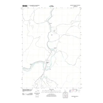
2011 Map of Horseshoe Bend
USGS Topo · Published 2011About this map
The Payette River carves a dominant path through this Boise County landscape, defining the layout of settlements and infrastructure in the early 21st century. The town of Horseshoe Bend sits at a strategic river bend, supported by the Power Canal and the legacy of local industry represented by the Horseshoe Bend Mill Pond Public Fishing Area. To the north, the small community of Gardena and the secluded Jerusalem Valley are tucked into the high terrain surrounding Mount Maria. Local history is anchored at the Pioneer Cemetery south of the main bend, while the network of mountain roads like Harris Creek Rd and Jerusalem Rd trace the rugged topography. This survey captures the region's character as a junction of water-driven power and transit routes leading into the Idaho interior.
Find a feature on this map
34 named features on this map. Tap any name to fly to it.
Don’t see what you’re looking for? This feature index may not catch every label — zoom into the map to look around manually.
Map Details
Editions of this 2011 Horseshoe Bend Map
This is the sole edition of this map. No revisions or reprints were ever made.
Other maps of this area

1892 · Boise
USGS Topo · 1:125,000

1894 · Squaw Creek
USGS Topo · 1:125,000

1897 · Boise
USGS Topo · 1:125,000

1953 · Banks
USGS Topo · 1:62,500

1953 · Montour
USGS Topo · 1:62,500

1955 · Baker
USGS Topo · 1:250,000

1955 · Boise
USGS Topo · 1:250,000

1957 · Cartwright Canyon
USGS Topo · 1:24,000

1957 · Horseshoe Bend
USGS Topo · 1:24,000
1957 · Shafer Butte
USGS Topo · 1:24,000