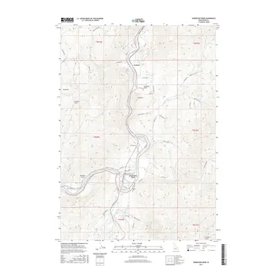
2017 Map of Horseshoe Bend
USGS Topo · Published 2017About this map
The Payette River carves a dramatic oxbow through Boise County, defining the location of Horseshoe Bend. This 2017 survey details the complex interface of high-elevation terrain and valley floor infrastructure, where the Power Canal follows the river's path westward toward Wakefield Gulch. To the south, Pioneer Cem stands as a point of interest for genealogists, situated near the transition from residential streets like River Ave to the more open slopes of t7n r2e.
Find a feature on this map
56 named features on this map. Tap any name to fly to it.
Don’t see what you’re looking for? This feature index may not catch every label — zoom into the map to look around manually.
Map Details
Editions of this 2017 Horseshoe Bend Map
This is the sole edition of this map. No revisions or reprints were ever made.
Other maps of this area

1892 · Boise
USGS Topo · 1:125,000

1894 · Squaw Creek
USGS Topo · 1:125,000

1897 · Boise
USGS Topo · 1:125,000

1953 · Banks
USGS Topo · 1:62,500

1953 · Montour
USGS Topo · 1:62,500

1955 · Baker
USGS Topo · 1:250,000

1955 · Boise
USGS Topo · 1:250,000

1957 · Cartwright Canyon
USGS Topo · 1:24,000

1957 · Horseshoe Bend
USGS Topo · 1:24,000
1957 · Shafer Butte
USGS Topo · 1:24,000