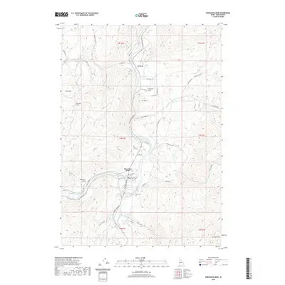
2020 Map of Horseshoe Bend
USGS Topo · Published 2020About this map
The Payette River carves a significant path through this Boise County landscape, defining the character of the settlements at Horseshoe Bend and Gardena. The river's influence is seen in the infrastructure supporting the area, including the Power Canal and the local road network that follows the water's contour, such as Horseshoe Bend Rd. The terrain is marked by prominent high points like South Mountain and Mt Maria, which rise above the surrounding gulches and narrow valleys.
Find a feature on this map
53 named features on this map. Tap any name to fly to it.
Don’t see what you’re looking for? This feature index may not catch every label — zoom into the map to look around manually.
Map Details
Editions of this 2020 Horseshoe Bend Map
This is the sole edition of this map. No revisions or reprints were ever made.
Other maps of this area

1892 · Boise
USGS Topo · 1:125,000

1894 · Squaw Creek
USGS Topo · 1:125,000

1897 · Boise
USGS Topo · 1:125,000

1953 · Banks
USGS Topo · 1:62,500

1953 · Montour
USGS Topo · 1:62,500

1955 · Baker
USGS Topo · 1:250,000

1955 · Boise
USGS Topo · 1:250,000

1957 · Cartwright Canyon
USGS Topo · 1:24,000

1957 · Horseshoe Bend
USGS Topo · 1:24,000
1957 · Shafer Butte
USGS Topo · 1:24,000