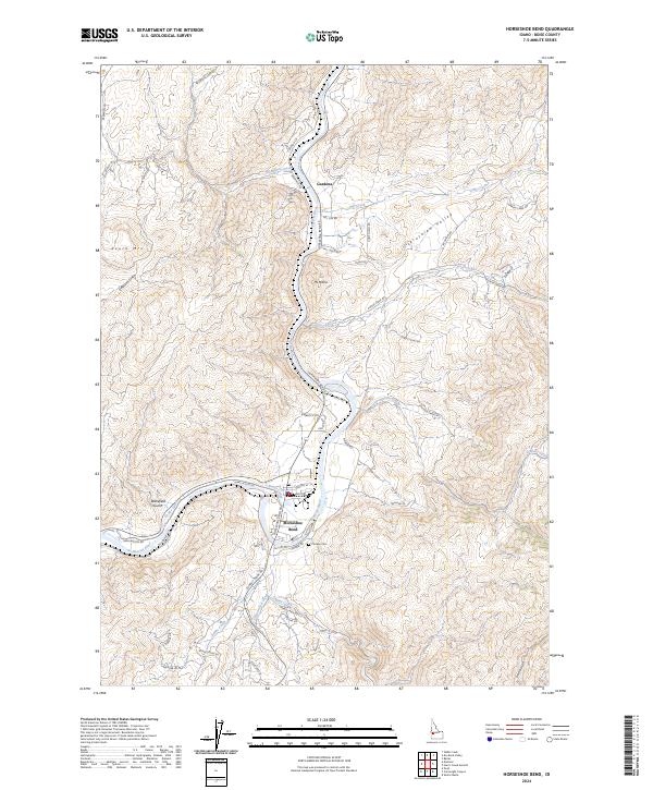
2024 Map of Horseshoe Bend
USGS Topo · Published 2024About this map
The Payette River creates a prominent loop as it passes through the settlement of Horseshoe Bend, carving through the Boise County landscape. This modern survey illustrates the complex intersection of natural watercourses and 20th-century water management, notably the Power Canal that parallels the river's western bank. To the north, the small community of Gardena sits near the confluence of Brownlee Creek and the main river channel, while the interior is defined by several gulches and ridges, such as South Mtn and Mt Maria. The presence of the Pioneer Cem south of the main town provides a point of interest for genealogists tracking early families in the region. The map also shows the extensive network of rural roads, including Old Emmett Rd and Harris Creek Rd, which provide access to the high elevations of Jerusalem Valley and the drainages of Jackass Creek and Shafer Creek.
Find a feature on this map
56 named features on this map. Tap any name to fly to it.
Don’t see what you’re looking for? This feature index may not catch every label — zoom into the map to look around manually.
Map Details
Editions of this 2024 Horseshoe Bend Map
This is the sole edition of this map. No revisions or reprints were ever made.
Other maps of this area

1892 · Boise
USGS Topo · 1:125,000

1894 · Squaw Creek
USGS Topo · 1:125,000

1897 · Boise
USGS Topo · 1:125,000

1953 · Banks
USGS Topo · 1:62,500

1953 · Montour
USGS Topo · 1:62,500

1955 · Baker
USGS Topo · 1:250,000

1955 · Boise
USGS Topo · 1:250,000

1957 · Cartwright Canyon
USGS Topo · 1:24,000

1957 · Horseshoe Bend
USGS Topo · 1:24,000
1957 · Shafer Butte
USGS Topo · 1:24,000