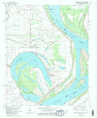
1981 Map of Horseshoe Lake
USGS Topo · Published 1982About this map
Horseshoe Lake and Porter Lake dominate this landscape within a massive bend of the Mississippi River, showcasing the complex hydrology of the Delta along the Arkansas-Mississippi border. The intricate network of oxbow lakes and secondary waterways, including Happy Jack Lake, Goose Lake, and Mud Lake, reflects the river's historical shifts. Human settlement is oriented around these water bodies and the river's edge, with numerous landings such as Seyppel Landing, Rock Point Landing, and Beard Landing facilitating river-based commerce and transport. The interior is dotted with small communities and family-named landmarks like Thompson Grove and Bruins, alongside numerous rural houses of worship including Mosley Temple Ch and Bright Star Ch. In the southeast corner, the Illinois Central Gulf railroad cuts through the terrain near the river, while several private clubs and cemeteries, such as Locust Grove Cem, provide clues for genealogical research in this alluvial region.
Find a feature on this map
62 named features on this map. Tap any name to fly to it.
Don’t see what you’re looking for? This feature index may not catch every label — zoom into the map to look around manually.
Map Details
Editions of this 1981 Horseshoe Lake Map
2 editions found
Other maps of this area

1908 · Lake Cormorant
USGS Topo · 1:24,000

1912 · Lake Cormorant
USGS Topo · 1:31,680

1916 · Memphis
USGS Topo · 1:62,500

1925 · Memphis
USGS Topo · 1:48,000

1927 · Memphis
USGS Topo · 1:62,500

1931 · Horseshoe Lake
USGS Topo · 1:62,500

1932 · Horn Lake
USGS Topo · 1:48,000

1935 · Horn Lake
USGS Topo · 1:62,500

1939 · Horseshoe Lake
USGS Topo · 1:62,500

1939 · Edmondson
USGS Topo · 1:62,500