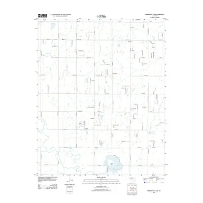
2013 Map of Horseshoe Lake
USGS Topo · Published 2013About this map
Horseshoe Lake and its surrounding wetlands anchor this landscape northeast of Oklahoma City, where the rural character of Oklahoma County is visible through a network of creeks and small family cemeteries. The terrain is defined by the winding course of Choctaw Cr to the south and the steady flow of Wildhorse Cr through the center, feeding into local water bodies like Wolf Ridge Lake. Small settlements and naming conventions such as Poole and Oakhill indicate localized clusters of development amid a dense grid of section roads like N Luther Rd and N Peebly Rd. For those researching family history, the presence of several established burial grounds, including Saint Paul Baptist Cem, Saint Mary Cem, and Mills Cem, provides specific points of interest for identifying early residents and church communities in this transitional area between the city's outskirts and the surrounding countryside.
Find a feature on this map
99 named features on this map. Tap any name to fly to it.
Don’t see what you’re looking for? This feature index may not catch every label — zoom into the map to look around manually.
Map Details
Editions of this 2013 Horseshoe Lake Map
This is the sole edition of this map. No revisions or reprints were ever made.
Other maps of this area

1892 · Moore
USGS Topo · 1:62,500

1892 · Edmond
USGS Topo · 1:62,500

1898 · Purcell
USGS Topo · 1:125,000

1909 · Luther
USGS Topo · 1:62,500

1930 · McLoud
USGS Topo · 1:62,500

1934 · Moore
USGS Topo · 1:62,500

1935 · Edmond
USGS Topo · 1:48,000

1938 · Moore
USGS Topo · 1:62,500

1940 · Edmond
USGS Topo · 1:62,500

1954 · Oklahoma City
USGS Topo · 1:250,000