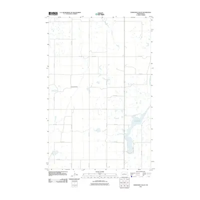
2011 Map of Horseshoe Valley
USGS Topo · Published 2011About this map
Horseshoe Valley defines this portion of McLean County, where the landscape is characterized by the expansive depression of the valley floor and a series of scattered wetlands and small water bodies. The most prominent hydrological feature is Crooked Lake, which stretches through the southeastern section of the quadrangle. The area is organized by a systematic grid of section roads, including 15th St NW, 17th St NW, and 23rd St NW, which facilitate travel across this rural agricultural territory.
Find a feature on this map
15 named features on this map. Tap any name to fly to it.
Don’t see what you’re looking for? This feature index may not catch every label — zoom into the map to look around manually.
Map Details
Editions of this 2011 Horseshoe Valley Map
This is the sole edition of this map. No revisions or reprints were ever made.
Other maps of this area

1929 · Coleharbor
USGS Topo · 1:62,500

1929 · Benedict
USGS Topo · 1:62,500

1929 · Kongsberg
USGS Topo · 1:62,500

1947 · Turtle Lake
USGS Topo · 1:62,500

1954 · McClusky
USGS Topo · 1:250,000

1958 · McClusky
USGS Topo · 1:250,000

1961 · Turtle Lake
USGS Topo · 1:24,000

1961 · Lake Nettie
USGS Topo · 1:24,000
1961 · Peterson Lake
USGS Topo · 1:24,000

1974 · Benedict SE
USGS Topo · 1:24,000