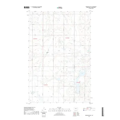
2018 Map of Horseshoe Valley
USGS Topo · Published 2018About this map
Horseshoe Valley defines this portion of McLean County, where the landscape is characterized by the numerous glacial potholes and wetlands common to the North Dakota prairie. The map shows a transition in terrain near Crooked Lake, where the depression of the valley interrupts the surrounding high ground. A systematic network of rural section-line roads, including 23rd St NW and 16th St NW, serves the agricultural tracts of the Missouri Plateau. These corridors, along with regional routes like Co Hwy 8 and Co Hwy 6, illustrate the modern transport pattern connecting isolated farmsteads and field systems within the survey boundaries of t149n r81w and t148n r80w.
Find a feature on this map
17 named features on this map. Tap any name to fly to it.
Don’t see what you’re looking for? This feature index may not catch every label — zoom into the map to look around manually.
Map Details
Editions of this 2018 Horseshoe Valley Map
This is the sole edition of this map. No revisions or reprints were ever made.
Other maps of this area

1929 · Coleharbor
USGS Topo · 1:62,500

1929 · Benedict
USGS Topo · 1:62,500

1929 · Kongsberg
USGS Topo · 1:62,500

1947 · Turtle Lake
USGS Topo · 1:62,500

1954 · McClusky
USGS Topo · 1:250,000

1958 · McClusky
USGS Topo · 1:250,000

1961 · Turtle Lake
USGS Topo · 1:24,000

1961 · Lake Nettie
USGS Topo · 1:24,000
1961 · Peterson Lake
USGS Topo · 1:24,000

1974 · Benedict SE
USGS Topo · 1:24,000