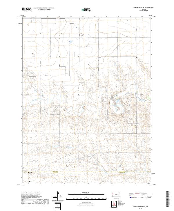
2022 Map of Horsethief Draw NE
USGS Topo · Published 2022About this map
N Fork Smoky Hill River meanders through this western Kansas landscape, providing the primary hydrologic character for a region defined by its wide section-line road grid. The map details the transition between Sherman and Wallace counties, capturing the rural infrastructure that sustains the High Plains. Evidence of early settlement and community life is anchored by Fairview Cem in the southwest and the recreational waters of Sherman County State Lake further east. The terrain is marked by dry drainage patterns like Sandy Cr and N Fork Lake Cr, which reveal the underlying topography of the Smoky Hills region. This 2022 survey serves as a precise record of the county road networks and land divisions that have structured the area for generations.
Find a feature on this map
27 named features on this map. Tap any name to fly to it.
Don’t see what you’re looking for? This feature index may not catch every label — zoom into the map to look around manually.
Map Details
Editions of this 2022 Horsethief Draw NE Map
This is the sole edition of this map. No revisions or reprints were ever made.
Other maps of this area

1954 · Goodland
USGS Topo · 1:250,000

1956 · Goodland
USGS Topo · 1:250,000

1957 · Goodland
USGS Topo · 1:250,000

1959 · Harris Draw
USGS Topo · 1:62,500

1959 · Horsethief Draw
USGS Topo · 1:62,500

1966 · Goodland
USGS Topo · 1:24,000

1966 · Ruleton
USGS Topo · 1:24,000
1966 · Ruleton SE
USGS Topo · 1:24,000
1979 · Horsethief Draw NW
USGS Topo · 1:24,000
1979 · Horsethief Draw
USGS Topo · 1:24,000