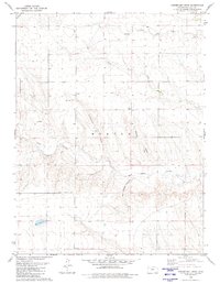
1979 Map of Horsethief Draw
USGS Topo · Published 1980About this map
Horsethief Cave sits within a landscape defined by deep drainage patterns and seasonal water sources in western Kansas. This 1970s topographical survey captures the remote character of Wallace County, where the terrain is carved by Horsethief Draw, Meyers Draw, and the prominent Salt Grass Canyon. The hydrology is dominated by the branching systems of Middle Fork Lake Creek and South Fork Lake Creek to the north, while the southern portion of the sheet features Goose Creek and the localized Big Lagoon. Evidence of early land use and human presence is sparse but specific, marked by a lone Grave near the center of the quadrangle and a series of wells and drill holes, such as McLane No 2, indicating the reach of ranching and resource exploration into these high plains draws.
Find a feature on this map
14 named features on this map. Tap any name to fly to it.
Don’t see what you’re looking for? This feature index may not catch every label — zoom into the map to look around manually.
Map Details
Editions of this 1979 Horsethief Draw Map
This is the sole edition of this map. No revisions or reprints were ever made.
Other maps of this area

1892 · Cheyenne Wells
USGS Topo · 1:125,000

1894 · Cheyenne Wells
USGS Topo · 1:125,000

1954 · Limon
USGS Topo · 1:250,000

1954 · Lamar
USGS Topo · 1:250,000

1954 · Goodland
USGS Topo · 1:250,000

1955 · Scott City
USGS Topo · 1:250,000

1956 · Goodland
USGS Topo · 1:250,000

1957 · Limon
USGS Topo · 1:250,000

1957 · Goodland
USGS Topo · 1:250,000

1958 · Limon
USGS Topo · 1:250,000