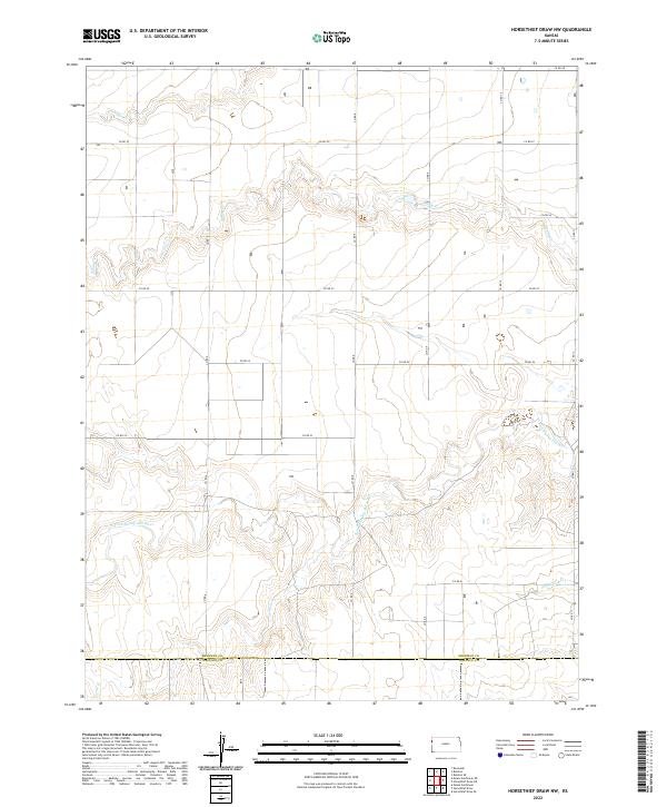
2022 Map of Horsethief Draw NW
USGS Topo · Published 2022About this map
The N Fork Smoky Hill River and its major tributaries define the drainage patterns of this High Plains landscape, where the Sherman Co Wallace Co line marks the southern boundary. This 2022 survey captures the expansive agricultural and ranching grid of Western Kansas, oriented around a network of section-line roads like Co RD 54 and Co RD 57. The branching headwaters of Sappa Cr and Sandy Cr incise the terrain, creating the distinct draws and breaks that provide topographic relief in an otherwise level prairie. Toward the southeast, the N Fork Lake Cr joins the river system, illustrating the vital hydrology that has dictated land use and settlement since the regional townships were first established.
Find a feature on this map
19 named features on this map. Tap any name to fly to it.
Don’t see what you’re looking for? This feature index may not catch every label — zoom into the map to look around manually.
Map Details
Editions of this 2022 Horsethief Draw NW Map
This is the sole edition of this map. No revisions or reprints were ever made.
Other maps of this area

1954 · Limon
USGS Topo · 1:250,000

1954 · Goodland
USGS Topo · 1:250,000

1956 · Goodland
USGS Topo · 1:250,000

1957 · Limon
USGS Topo · 1:250,000

1957 · Goodland
USGS Topo · 1:250,000

1958 · Limon
USGS Topo · 1:250,000

1959 · Horsethief Draw
USGS Topo · 1:62,500

1966 · Ruleton
USGS Topo · 1:24,000
1966 · Ruleton SE
USGS Topo · 1:24,000
1969 · Mount Sunflower
USGS Topo · 1:24,000