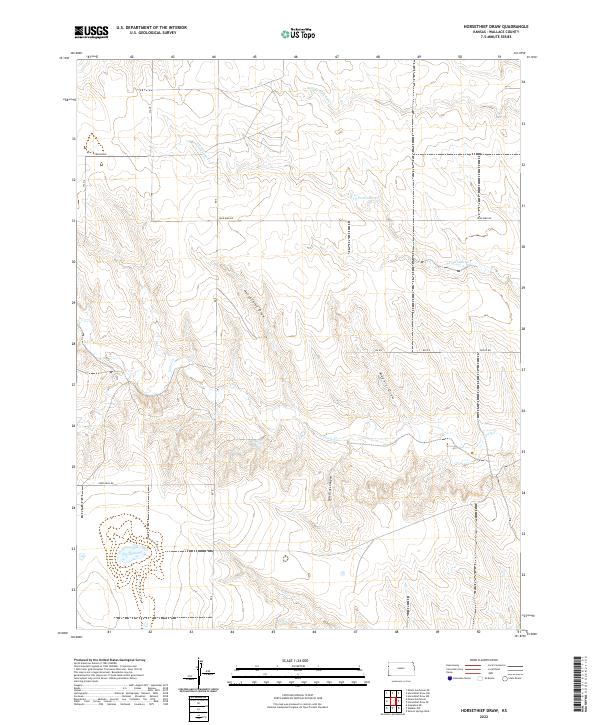
2022 Map of Horsethief Draw
USGS Topo · Published 2022About this map
Horsethief Draw and Meyers Draw define the drainage patterns of this Wallace County landscape, where deep erosional features cut through the High Plains. The terrain is marked by seasonal watercourses and unique local landmarks such as Salt Grass Canyon and the isolated waters of Big Lagoon. This modern survey reveals a network of rural routes including Blue Bird Rd, Zigzag Rd, and Xpressway Rd, which facilitate movement through a region dominated by agricultural land divisions.
Find a feature on this map
20 named features on this map. Tap any name to fly to it.
Don’t see what you’re looking for? This feature index may not catch every label — zoom into the map to look around manually.
Map Details
Editions of this 2022 Horsethief Draw Map
This is the sole edition of this map. No revisions or reprints were ever made.
Other maps of this area

1892 · Cheyenne Wells
USGS Topo · 1:125,000

1894 · Cheyenne Wells
USGS Topo · 1:125,000

1954 · Limon
USGS Topo · 1:250,000

1954 · Lamar
USGS Topo · 1:250,000

1954 · Goodland
USGS Topo · 1:250,000

1955 · Scott City
USGS Topo · 1:250,000

1956 · Goodland
USGS Topo · 1:250,000

1957 · Limon
USGS Topo · 1:250,000

1957 · Goodland
USGS Topo · 1:250,000

1958 · Limon
USGS Topo · 1:250,000