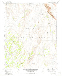
1981 Map of Horsethief Mesa
USGS Topo · Published 1982About this map
Navajo Indian Reservation land dominates this high-desert plateau survey, where water sources like Circular Tank and the Red Bluff Windmill define the patterns of human activity. The landscape is characterized by prominent geological formations, most notably the namesake Horsethief Mesa and the distinctively named Sitting Lizard Rock.
Find a feature on this map
11 named features on this map. Tap any name to fly to it.
Don’t see what you’re looking for? This feature index may not catch every label — zoom into the map to look around manually.
Map Details
Editions of this 1981 Horsethief Mesa Map
This is the sole edition of this map. No revisions or reprints were ever made.
Other maps of this area

1886 · Echo Cliffs
USGS Topo · 1:250,000

1891 · Echo Cliffs
USGS Topo · 1:250,000

1954 · Leche-E Rock
USGS Topo · 1:62,500

1954 · Navajo Creek
USGS Topo · 1:62,500

1956 · Marble Canyon
USGS Topo · 1:250,000

1959 · Marble Canyon
USGS Topo · 1:250,000

1961 · Marble Canyon
USGS Topo · 1:250,000
1981 · Kaibito
USGS Topo · 1:24,000
1982 · White Hill
USGS Topo · 1:24,000
1982 · Arrowhead Mesa
USGS Topo · 1:24,000