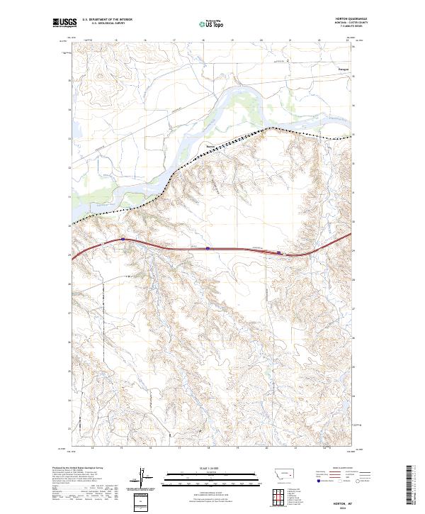
2024 Map of Horton
USGS Topo · Published 2024About this map
Horton and Paragon sit at the center of this Custer County landscape, where the Yellowstone River snakes through the northern territory. The map illustrates a transition from the wide river valley to the intricate drainage systems that define the southern uplands. Tributaries such as Whitetail Creek, Cottonwood Creek, and Moon Creek carve through the terrain, creating a complex network of draws and ridges including Reynolds Draw. Transportation is primarily defined by the corridor following the river, featuring Sheffield Rd, while rural access points like Moon Creek Rd and Rd 613 provide a framework for the agricultural and ranching lands. This modern survey reflects the enduring character of eastern Montana's waterways, from the West Fork Moon Creek to Steiger Creek, maintaining a legacy of place names that have anchored this region for generations.
Find a feature on this map
23 named features on this map. Tap any name to fly to it.
Don’t see what you’re looking for? This feature index may not catch every label — zoom into the map to look around manually.
Map Details
Editions of this 2024 Horton Map
This is the sole edition of this map. No revisions or reprints were ever made.
Other maps of this area

1953 · Miles City
USGS Topo · 1:250,000

1954 · Forsyth
USGS Topo · 1:250,000

1957 · Miles City
USGS Topo · 1:250,000

1957 · Forsyth
USGS Topo · 1:250,000

1958 · Miles City
USGS Topo · 1:250,000

1958 · Forsyth
USGS Topo · 1:250,000

1968 · Hathaway
USGS Topo · 1:24,000

1968 · Big Hill
USGS Topo · 1:24,000

1968 · Lignite Creek
USGS Topo · 1:24,000

1968 · Butterfly Creek
USGS Topo · 1:24,000