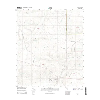
2015 Map of Hosford
USGS Topo · Published 2015About this map
The community of Hosford serves as the focal point of this Liberty County landscape, situated where local routes like NE Shuler St and NE Roberts St converge. North of this settlement lies Lowry, an area defined by timber and industrial activity as evidenced by the presence of Lawry Chip Plant Rd and NE Lowery Industrial Rd. This 2015 survey illustrates a terrain deeply dissected by numerous watercourses, including the winding Telogia Cr and the expansive drainage of Big Cr. Local genealogy is anchored by the Kent Cem located near the Gadsden County line, while named water features like Murray Head and White Panther Cr highlight the intricate hydrography of the Florida Panhandle. The map provides a clear record of family-named roadways, such as NE M York Shuler Rd and NE Grannie Annie Rd, which document the local cultural geography of the early 21st century.
Find a feature on this map
36 named features on this map. Tap any name to fly to it.
Don’t see what you’re looking for? This feature index may not catch every label — zoom into the map to look around manually.
Map Details
Editions of this 2015 Hosford Map
This is the sole edition of this map. No revisions or reprints were ever made.
Other maps of this area

1943 · Lake Talquin
USGS Topo · 1:62,500

1945 · Hosford
USGS Topo · 1:31,680

1945 · Bristol
USGS Topo · 1:31,680

1945 · Woods
USGS Topo · 1:31,680

1945 · Telogia
USGS Topo · 1:24,000

1946 · Telogia
USGS Topo · 1:31,680

1954 · Tallahassee
USGS Topo · 1:250,000

1955 · Rock Bluff
USGS Topo · 1:24,000

1955 · Sycamore
USGS Topo · 1:24,000

1959 · Tallahassee
USGS Topo · 1:250,000