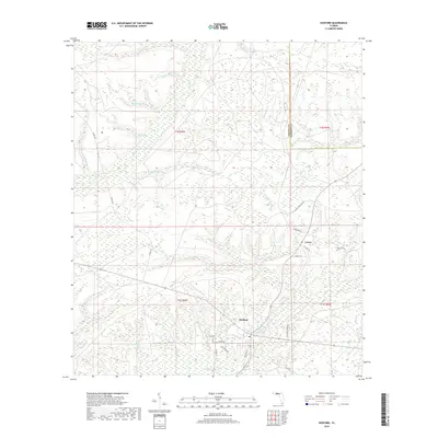
2018 Map of Hosford
USGS Topo · Published 2018About this map
The settlement of Hosford serves as a focal point for this section of Liberty County, situated amidst a dense network of watercourses and wetlands. The landscape is defined by the drainage patterns of Telogia Cr and its numerous tributaries, including White Panther Cr and Big Cr. To the north, the boundary with Gadsden County is marked near Ocklawaha Cr, while the terrain to the west features the marshy expanse of Bumpy Bay. Local history and genealogy are anchored by the small community of Lowry and the nearby Kent Cem east of the main settlement. The transportation network is primarily composed of county roads like Co RD 1641 and Co RD 267, alongside local lanes such as Beagle Dr and NE Granny Annie Rd that provide access to the rural interiors of the Florida Panhandle.
Find a feature on this map
32 named features on this map. Tap any name to fly to it.
Don’t see what you’re looking for? This feature index may not catch every label — zoom into the map to look around manually.
Map Details
Editions of this 2018 Hosford Map
This is the sole edition of this map. No revisions or reprints were ever made.
Other maps of this area

1943 · Lake Talquin
USGS Topo · 1:62,500

1945 · Hosford
USGS Topo · 1:31,680

1945 · Bristol
USGS Topo · 1:31,680

1945 · Woods
USGS Topo · 1:31,680

1945 · Telogia
USGS Topo · 1:24,000

1946 · Telogia
USGS Topo · 1:31,680

1954 · Tallahassee
USGS Topo · 1:250,000

1955 · Rock Bluff
USGS Topo · 1:24,000

1955 · Sycamore
USGS Topo · 1:24,000

1959 · Tallahassee
USGS Topo · 1:250,000