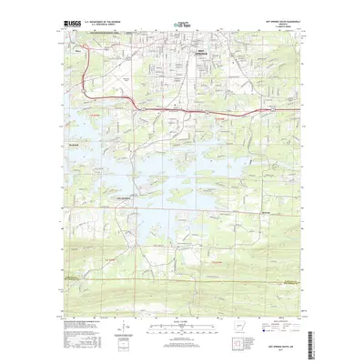
2017 Map of Hot Springs South
USGS Topo · Published 2017About this map
Hot Springs National Park borders the northern edge of this Arkansas landscape, where the urban development of Hot Springs transitions into the finger-like inlets of Lake Hamilton. The area's complex burial history is well-documented through numerous sites including Greenwood Cem, Jewish Rest Cem, and Hollywood Cem near the city center, while Files Cem and Mount Carmel Creek Cem are located further south in more rural terrain. Transport and infrastructure are centered around Memorial Field and a dense network of residential peninsulas reaching into the lake, such as Housley Pt and Wilson Pt. Further south, the terrain rises toward Trap Mtn and the Garland and Hot Spring county line, where the landscape shifts from suburban lakefront to the drainages of Mount Carmel Cr and Fourche-a-Loupe Cr.
Find a feature on this map
248 named features on this map. Tap any name to fly to it.
Don’t see what you’re looking for? This feature index may not catch every label — zoom into the map to look around manually.
Map Details
Editions of this 2017 Hot Springs South Map
This is the sole edition of this map. No revisions or reprints were ever made.
Other maps of this area

1890 · Benton
USGS Topo · 1:125,000

1890 · Hot Springs
USGS Topo · 1:125,000

1894 · Hot Springs
USGS Topo · 1:125,000

1894 · Benton
USGS Topo · 1:125,000

1948 · Malvern
USGS Topo · 1:62,500

1949 · Malvern
USGS Topo · 1:62,500

1955 · Little Rock
USGS Topo · 1:250,000

1956 · Little Rock
USGS Topo · 1:250,000

1960 · Little Rock
USGS Topo · 1:250,000

1964 · Little Rock
USGS Topo · 1:250,000