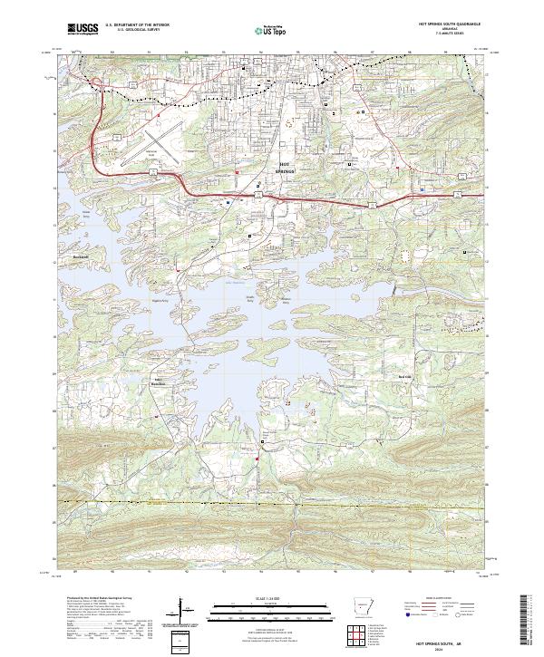
2024 Map of Hot Springs South
USGS Topo · Published 2024About this map
Hot Springs National Park borders the northern edge of this Arkansas landscape, where the urban grid of Hot Springs transitions into the finger-like inlets of Lake Hamilton. The mapping reveals a distinct heritage of river crossings and local resting places, including Jewish Rest Cem and Hollywood Cem. The presence of several historical ferry locations along the lake and the Ouachita River, such as Higdon Ferry and Ralston Ferry, highlights how the local geography once relied on these water transit points before modern bridge infrastructure dominated. South of the city, the terrain is defined by water bodies like Molly Creek and Stokes Creek, while the southern boundary marks the transition between Garland Co and Hot Spring Co near the heights of Trap Mtn.
Find a feature on this map
134 named features on this map. Tap any name to fly to it.
Don’t see what you’re looking for? This feature index may not catch every label — zoom into the map to look around manually.
Map Details
Editions of this 2024 Hot Springs South Map
This is the sole edition of this map. No revisions or reprints were ever made.
Other maps of this area

1890 · Benton
USGS Topo · 1:125,000

1890 · Hot Springs
USGS Topo · 1:125,000

1894 · Hot Springs
USGS Topo · 1:125,000

1894 · Benton
USGS Topo · 1:125,000

1948 · Malvern
USGS Topo · 1:62,500

1949 · Malvern
USGS Topo · 1:62,500

1955 · Little Rock
USGS Topo · 1:250,000

1956 · Little Rock
USGS Topo · 1:250,000

1960 · Little Rock
USGS Topo · 1:250,000

1964 · Little Rock
USGS Topo · 1:250,000