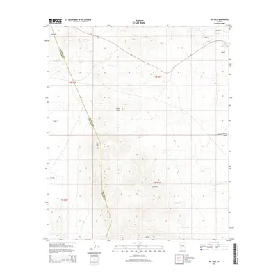
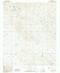
2014 Map of Hot Well
USGS Topo · Published 2014About this map
Fox sits at the northern edge of this high-desert landscape in 2014, where the Gila River cuts through the northeast corner. This territory is defined by complex drainage systems and volcanic landforms, straddling the county line between Greenlee and Graham County. The topography rises from the Whitlock Valley into the Peloncillo Mountains and prominent peaks like Flat Top. Numerous arroyos and canyons, including Hot Well Draw and the distinctive Blackfield Canyon, reveal the erosional patterns of this arid environment. Significant landmarks like Indian Rocks and the namesake Hot Well point toward the unique geological features of the Gila River valley. Transport remains anchored by the diagonal route of Us-70 and local connectors like Burma RD and Old Duncan HWY, tracing paths through a region shaped by both ancient rock formations and modern ranching or transit corridors.
Find a feature on this map
24 named features on this map. Tap any name to fly to it.
Don’t see what you’re looking for? This feature index may not catch every label — zoom into the map to look around manually.
Map Details
Editions of this 2014 Hot Well Map
This is the sole edition of this map. No revisions or reprints were ever made.
Other maps of this area

1954 · Silver City
USGS Topo · 1:250,000

1958 · Silver City
USGS Topo · 1:250,000

1959 · York Valley
USGS Topo · 1:62,500

1960 · Guthrie
USGS Topo · 1:62,500

1960 · Duncan
USGS Topo · 1:62,500

1962 · Silver City
USGS Topo · 1:250,000
1966 · Whitlock Cienega
USGS Topo · 1:24,000
1966 · Whitlock Mts. NE
USGS Topo · 1:24,000
1986 · Sheldon
USGS Topo · 1:24,000
1986 · Ash Peak
USGS Topo · 1:24,000