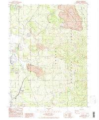
1986 Map of Hotlum
USGS Topo · Published 1986About this map
Hotlum sits at the base of the northern slopes of Mount Shasta, situated within the massive volcanic terrain of the Shasta National Forest. The landscape recorded in this 1986 survey is defined by ancient and more recent geological activity, featuring extensive lava beds and the prominent Cinder Cone rising above the surrounding timber. Along the western edge of the quadrangle, the town of Weed marks the transition from the high-altitude forests to the more industrial and developed corridor of the Shasta Valley. This map details the complex network of forest roads and trails that navigate the steep terrain, including routes leading toward the Diller Canyon and the high ridges of the Cascade Range. It serves as a vital record of the wilderness and industrial boundaries in Siskiyou County during the mid-1980s.
Find a feature on this map
2 named features on this map. Tap any name to fly to it.
Don’t see what you’re looking for? This feature index may not catch every label — zoom into the map to look around manually.
Map Details
Editions of this 1986 Hotlum Map
2 editions found
Other maps of this area

1886 · Shasta
USGS Topo · 1:250,000

1894 · Shasta
USGS Topo · 1:250,000

1922 · Shasta Valley Sheet No 10
USGS Topo · 1:24,000

1922 · Shasta Valley Sheet No 9
USGS Topo · 1:24,000

1934 · Macdoel
USGS Topo · 1:96,000

1935 · Dunsmuir
USGS Topo · 1:125,000

1941 · Macdoel
USGS Topo · 1:125,000

1948 · Weed
USGS Topo · 1:250,000

1950 · Weed
USGS Topo · 1:250,000

1954 · The Whaleback
USGS Topo · 1:62,500