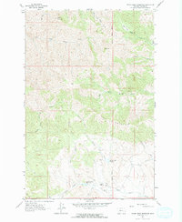
1961 Map of Hound Creek Reservoir
USGS Topo · Published 1964About this map
Sieben Ranch stands as a primary point of human settlement in this high-altitude landscape of central Montana, captured here during the early 1960s. The topography is defined by the Montana Principal Meridian, which cuts through a region of sharp elevation changes and complex drainage systems. Water management is a visible priority for the area's ranching interests, evidenced by the Hound Creek Reservoir and the Spring Creek Reservoir.
Find a feature on this map
21 named features on this map. Tap any name to fly to it.
Don’t see what you’re looking for? This feature index may not catch every label — zoom into the map to look around manually.
Map Details
Editions of this 1961 Hound Creek Reservoir Map
2 editions found
Other maps of this area

1886 · Great Falls
USGS Topo · 1:250,000

1886 · Fort Logan
USGS Topo · 1:250,000

1948 · White Sulphur Springs
USGS Topo · 1:250,000

1954 · Great Falls
USGS Topo · 1:250,000

1957 · Great Falls
USGS Topo · 1:250,000

1958 · White Sulphur Springs
USGS Topo · 1:250,000

1961 · White Sulphur Springs
USGS Topo · 1:250,000

1961 · Hardy
USGS Topo · 1:24,000

1961 · Hound Creek Reservoir
USGS Topo · 1:24,000

1961 · Rocky Reef
USGS Topo · 1:24,000