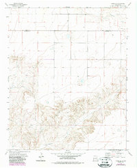
1973 Map of House SE
USGS Topo · Published 1987About this map
Alamosa Creek carves a deep, winding path through the high plains of Eastern New Mexico, defining much of the drainage pattern in this rural landscape. The topography transitions from the flat, open mesa tops in the north to a complex network of canyons and ravines as the terrain drops toward the creek bed. This 1973 survey, updated in the late 1980s, captures the boundary line of Quay Co Roosevelt Co as it cuts across the northern range. The map documents several isolated water sources, including scattered Wells and a lone Well, which are critical infrastructure in this arid environment. A small industrial or mineral site identified only as Wm appears in the eastern reaches, suggesting the small-scale ranching or mining activity that has historically supported this corner of the state.
Find a feature on this map
5 named features on this map. Tap any name to fly to it.
Don’t see what you’re looking for? This feature index may not catch every label — zoom into the map to look around manually.
Map Details
Editions of this 1973 House SE Map
2 editions found
Other maps of this area

1954 · Clovis
USGS Topo · 1:250,000

1957 · Melrose
USGS Topo · 1:62,500

1958 · Clovis
USGS Topo · 1:250,000

1973 · Tolar
USGS Topo · 1:24,000

1973 · Weber City
USGS Topo · 1:24,000

1973 · Krider
USGS Topo · 1:24,000

1973 · House
USGS Topo · 1:24,000

1973 · Melrose West
USGS Topo · 1:24,000
1973 · Peach Canyon
USGS Topo · 1:24,000

1973 · Mc Alister
USGS Topo · 1:24,000