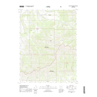
2019 Map of Housetop Mountain
USGS Topo · Published 2019About this map
Housetop Mountain serves as the namesake landmark for this high-elevation landscape on the border of White River National Forest and Grand Mesa National Forest. The map documents a complex drainage system where the headwaters of Wallace Cr and its tributaries, such as N Fork Wallace Cr and Snowslide Cr, have carved deep incisions into the plateau. Elevated landforms like Creek Mesa and Samson Mesa define the western portion of the quadrangle, while the southern terrain is dominated by Castle Peak and the sprawling Lugans Basin. The placement of Co HWY 306 and Wallace Creek Rd reveals the primary access routes used for forest management and ranching in this part of Mesa County.
Find a feature on this map
35 named features on this map. Tap any name to fly to it.
Don’t see what you’re looking for? This feature index may not catch every label — zoom into the map to look around manually.
Map Details
Editions of this 2019 Housetop Mountain Map
This is the sole edition of this map. No revisions or reprints were ever made.
Other maps of this area

1929 · Grand Valley
USGS Topo · 1:62,500

1955 · Collbran
USGS Topo · 1:24,000

1955 · Mesa
USGS Topo · 1:24,000

1955 · Molina
USGS Topo · 1:24,000

1956 · Grand Junction
USGS Topo · 1:250,000

1957 · Leadville
USGS Topo · 1:250,000

1959 · Grand Junction
USGS Topo · 1:250,000

1959 · Leadville
USGS Topo · 1:250,000

1960 · Leadville
USGS Topo · 1:250,000

1960 · Grand Junction
USGS Topo · 1:250,000