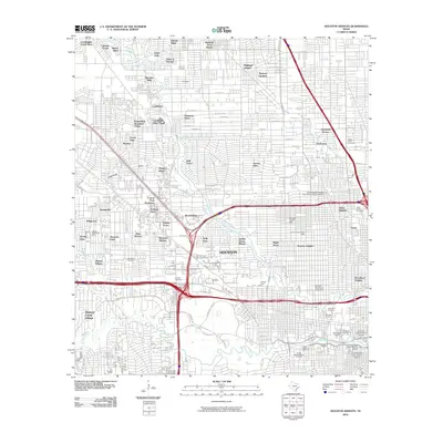
2010 Map of Houston Heights
USGS Topo · Published 2010About this map
Buffalo Bayou and Whiteoak Bayou carve through the urban landscape of Houston, defining the geography of historic residential districts and industrial corridors. In this 2010 survey, the Independence Heights Residential Historic District stands as a significant landmark of early African American civic history, while the Old Sixth Ward Historic District and Freedmens Town Historic District reflect the long-standing heritage of the city's urban core. Industrial and transportation hubs like the Chaney Yard and Eureka Yard illustrate the massive rail infrastructure supporting the region's economy.
Find a feature on this map
106 named features on this map. Tap any name to fly to it.
Don’t see what you’re looking for? This feature index may not catch every label — zoom into the map to look around manually.
Map Details
Editions of this 2010 Houston Heights Map
This is the sole edition of this map. No revisions or reprints were ever made.
Other maps of this area

1915 · Bellaire
USGS Topo · 1:24,000

1915 · Park Place
USGS Topo · 1:24,000

1915 · Houston Heights
USGS Topo · 1:24,000

1915 · Alief
USGS Topo · 1:24,000

1915 · Hillendahl
USGS Topo · 1:24,000

1916 · Aldine
USGS Topo · 1:24,000

1916 · Settegast
USGS Topo · 1:24,000

1916 · Satsuma
USGS Topo · 1:24,000

1916 · Humble
USGS Topo · 1:24,000

1918 · Hillendahl
USGS Topo · 1:31,680