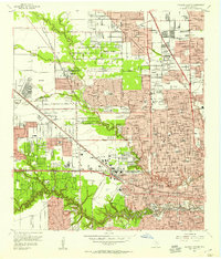
1955 Map of Houston Heights
USGS Topo · Published 1957About this map
White Oak Bayou and Buffalo Bayou carve through the landscape of northwest Houston, where industrial corridors and residential expansion meet in the mid-1950s. The map illustrates a complex network of railways including the Southern Pacific RR and Texas and New Orleans RR, converging at the Eureka Yard. This era reveals a densely developed suburban fabric characterized by numerous neighborhood schools like Reagan High Sch and Geo Washington Carver High Sch, alongside local landmarks like the Heights Hospital.
Find a feature on this map
105 named features on this map. Tap any name to fly to it.
Don’t see what you’re looking for? This feature index may not catch every label — zoom into the map to look around manually.
Map Details
Editions of this 1955 Houston Heights Map
This is the sole edition of this map. No revisions or reprints were ever made.
Other maps of this area

1915 · Bellaire
USGS Topo · 1:24,000

1915 · Park Place
USGS Topo · 1:24,000

1915 · Houston Heights
USGS Topo · 1:24,000

1915 · Alief
USGS Topo · 1:24,000

1915 · Hillendahl
USGS Topo · 1:24,000

1916 · Aldine
USGS Topo · 1:24,000

1916 · Settegast
USGS Topo · 1:24,000

1916 · Satsuma
USGS Topo · 1:24,000

1916 · Humble
USGS Topo · 1:24,000

1918 · Hillendahl
USGS Topo · 1:31,680