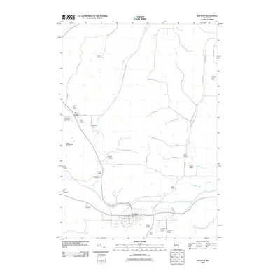
2010 Map of Houston
USGS Topo · Published 2010About this map
The Root River and its South Fork define the valley floor where the city of Houston serves as a regional hub in the southeast corner of Minnesota. This 2010 survey details a landscape where agriculture and community identity are deeply tied to the coulees and hollows, such as Skunk Hollow and Paradise Valley. The map is a significant resource for genealogists, as it preserves the locations of numerous small burial grounds including the Omodt Family Cemetery, First Swedish Baptist Cemetery, and the Swenson and Anderson Cemetery.
Find a feature on this map
58 named features on this map. Tap any name to fly to it.
Don’t see what you’re looking for? This feature index may not catch every label — zoom into the map to look around manually.
Map Details
Editions of this 2010 Houston Map
This is the sole edition of this map. No revisions or reprints were ever made.
Other maps of this area

1930 · La Crescent
USGS Topo · 1:62,500

1956 · Brownsville
USGS Topo · 1:62,500

1956 · La Crescent
USGS Topo · 1:62,500

1958 · Houston
USGS Topo · 1:62,500

1958 · La Crosse
USGS Topo · 1:250,000

1961 · La Crosse
USGS Topo · 1:250,000

1965 · La Crosse
USGS Topo · 1:250,000

1965 · Sheldon
USGS Topo · 1:24,000

1965 · Yucatan
USGS Topo · 1:24,000
1973 · Pickwick
USGS Topo · 1:24,000