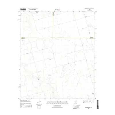
2016 Map of Houston Ranch
USGS Topo · Published 2016About this map
Houston Ranch serves as a central landmark in this high plains landscape where the borders of Glasscock, Martin, and Howard counties meet. The terrain is defined by wide drainages such as Mustang Draw and Hamilton Draw, which cut through the level topography typical of this part of West Texas. In the southeast corner, the elevation rises toward the summit of Hog Mtn, providing a distinct geographic marker against the surrounding plains. The map illustrates a developed network of rural infrastructure, including Farm Rd 307 and S Fm 818, alongside numerous county roads that link the ranch lands with the small community of Lomax. This 2016 survey documents the modern layout of these historic ranching territories, showing the persistent importance of land divisions and seasonal watercourses in defining the region.
Find a feature on this map
20 named features on this map. Tap any name to fly to it.
Don’t see what you’re looking for? This feature index may not catch every label — zoom into the map to look around manually.
Map Details
Editions of this 2016 Houston Ranch Map
This is the sole edition of this map. No revisions or reprints were ever made.
Other maps of this area

1941 · Morita
USGS Topo · 1:62,500

1949 · Morita
USGS Topo · 1:62,500

1954 · Big Spring
USGS Topo · 1:250,000

1954 · San Angelo
USGS Topo · 1:250,000

1958 · San Angelo
USGS Topo · 1:250,000

1958 · Big Spring
USGS Topo · 1:250,000

1964 · Dewey Lake NE
USGS Topo · 1:24,000

1965 · San Angelo
USGS Topo · 1:250,000

1965 · Dewey Lake
USGS Topo · 1:24,000

1965 · Spraberry
USGS Topo · 1:24,000