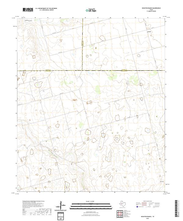
2022 Map of Houston Ranch
USGS Topo · Published 2022About this map
The high plains of West Texas intersect at a rare tri-county boundary in this 2022 survey, where Martin, Howard, and Glasscock counties meet. The landscape is defined by the ephemeral drainage of Mustang Draw and Hamilton Draw, which carve subtle paths through the terrain. The settlement of Lomax sits in the northeast, serving as a focal point for a network of rural routes like Co Rd 10 and W C R 8. To the southeast, the topography rises toward Hog Mtn, a distinct elevation point in an otherwise broad expanse of ranching country. The geometric precision of Farm Rd 307 and other section-line roads illustrates the systematic land division characteristic of this region's modern agricultural and oil-producing economy.
Find a feature on this map
19 named features on this map. Tap any name to fly to it.
Don’t see what you’re looking for? This feature index may not catch every label — zoom into the map to look around manually.
Map Details
Editions of this 2022 Houston Ranch Map
This is the sole edition of this map. No revisions or reprints were ever made.
Other maps of this area

1941 · Morita
USGS Topo · 1:62,500

1949 · Morita
USGS Topo · 1:62,500

1954 · Big Spring
USGS Topo · 1:250,000

1954 · San Angelo
USGS Topo · 1:250,000

1958 · San Angelo
USGS Topo · 1:250,000

1958 · Big Spring
USGS Topo · 1:250,000

1964 · Dewey Lake NE
USGS Topo · 1:24,000

1965 · San Angelo
USGS Topo · 1:250,000

1965 · Dewey Lake
USGS Topo · 1:24,000

1965 · Spraberry
USGS Topo · 1:24,000