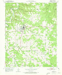
1951 Map of Houston
USGS Topo · Published 1973About this map
Houston serves as the central hub of this Missouri landscape, situated where the terrain begins to break into the deep hollows of the Big Piney River drainage. In the early 1950s, the town's footprint was concentrated around its main thoroughfares, featuring a Gaging Station and Sewage Disposal plant that supported its growing infrastructure. Outside the town center, the map reveals a rural network of family and community landmarks, including the County Farm Cem and several one-room schoolhouses like Oak Hill Sch and Brown Hill Sch.
Find a feature on this map
43 named features on this map. Tap any name to fly to it.
Don’t see what you’re looking for? This feature index may not catch every label — zoom into the map to look around manually.
Map Details
Editions of this 1951 Houston Map
4 editions found
Other maps of this area

1941 · Bado
USGS Topo · 1:62,500

1943 · Bado
USGS Topo · 1:62,500

1945 · Clear Springs
USGS Topo · 1:62,500

1948 · Clear Springs
USGS Topo · 1:62,500

1949 · Rolla
USGS Topo · 1:250,000

1951 · Licking
USGS Topo · 1:24,000

1951 · Raymondville
USGS Topo · 1:24,000

1951 · Prescott
USGS Topo · 1:24,000

1951 · Houston
USGS Topo · 1:24,000

1951 · Cabool NE
USGS Topo · 1:24,000