
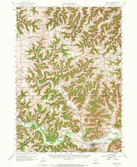
1958 Map of Houston
USGS Topo · Published 1959About this map
Houston serves as a vital rail and river hub along the Root River in this 1958 topographic study. The landscape is defined by the sharp transition between the river valleys and the upland ridges, where small agricultural communities like Ridgeway and Witoka established themselves away from the floodplains. The map documents an extensive network of rural education and faith, featuring numerous country schools such as Vinegar Hill Sch and Howard Sch, alongside spiritual centers like the Immaculate Conception Ch.
Find a feature on this map
71 named features on this map. Tap any name to fly to it.
Don’t see what you’re looking for? This feature index may not catch every label — zoom into the map to look around manually.
Map Details
Editions of this 1958 Houston Map
2 editions found
Other maps of this area

1929 · Fountain City
USGS Topo · 1:62,500

1929 · Galesville
USGS Topo · 1:62,500

1930 · La Crescent
USGS Topo · 1:62,500

1932 · Cochrane
USGS Topo · 1:62,500

1934 · Winona
USGS Topo · 1:62,500

1934 · Cochrane
USGS Topo · 1:62,500

1937 · Winona
USGS Topo · 1:62,500

1937 · Cochrane
USGS Topo · 1:62,500

1953 · Eau Claire
USGS Topo · 1:250,000

1954 · Lewiston
USGS Topo · 1:62,500