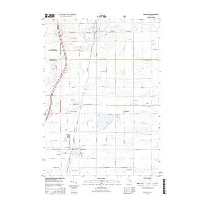
2014 Map of Howard City
USGS Topo · Published 2014About this map
Howard City and Morley serve as the primary population centers along the boundary of Mecosta and Montcalm counties. This portion of central Michigan is defined by the winding course of the Little Muskegon River, which feeds into Morley Pond near the northern edge of the map. The landscape is a mix of agricultural plots and protected woodlands, with a significant section of the Manistee National Forest occupying the western reaches. For genealogists, the map is particularly detailed, identifying five distinct burial grounds including Saint Apollonia Cem, Aetna Cem, and the Reynolds Cem. To the east, the small settlement of Amble sits near Crane Lake, surrounded by a network of drainage systems like the Weatherby Drain and Indian Cr Drain. The residential development around Indian Lake features a dense grid of locally named streets such as Thunder Bay Dr and Apache Trl.
Find a feature on this map
109 named features on this map. Tap any name to fly to it.
Don’t see what you’re looking for? This feature index may not catch every label — zoom into the map to look around manually.
Map Details
Editions of this 2014 Howard City Map
This is the sole edition of this map. No revisions or reprints were ever made.
Other maps of this area

1954 · Midland
USGS Topo · 1:250,000

1958 · Midland
USGS Topo · 1:250,000

1958 · Sand Lake
USGS Topo · 1:62,500

1958 · Woodville
USGS Topo · 1:62,500

1958 · Big Rapids
USGS Topo · 1:62,500

1959 · Midland
USGS Topo · 1:250,000

1959 · Howard City
USGS Topo · 1:62,500

1966 · Midland
USGS Topo · 1:250,000

1976 · Big Rapids SE
USGS Topo · 1:24,000

1976 · Big Rapids SW
USGS Topo · 1:24,000