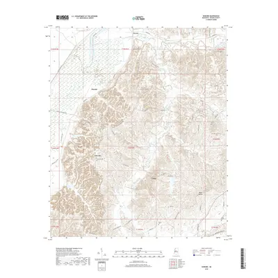
2018 Map of Howard
USGS Topo · Published 2018About this map
Fannegusha Creek and Black Creek wind through the northern lowlands of this Holmes County landscape, where the alluvial plain meets the rising hill country. Small, persistent settlements such as Tolarville, Eulogy, and Blissdale are connected by a network of rural routes including Thornton Tolarville Rd and Queenie M Johnson Rd. The map is particularly rich for genealogical research, documenting numerous family-named burial sites like Old Rankin Cem, Boatwright Cem, and Tredwell Cem. The terrain is defined by the drainages of Harland Creek and Moccasin Cr, which carve through the elevations south of Howard. This modern survey preserves the locations of local landmarks and community centers such as Pine Grove and the Oak Grove Cem along Oak Grove Rd, illustrating the enduring settlement patterns of central Mississippi.
Find a feature on this map
52 named features on this map. Tap any name to fly to it.
Don’t see what you’re looking for? This feature index may not catch every label — zoom into the map to look around manually.
Map Details
Editions of this 2018 Howard Map
This is the sole edition of this map. No revisions or reprints were ever made.
Other maps of this area

1940 · Lexington
USGS Topo · 1:62,500

1940 · Mileston
USGS Topo · 1:62,500

1953 · Greenwood
USGS Topo · 1:250,000

1954 · Mileston
USGS Topo · 1:62,500

1955 · Jackson
USGS Topo · 1:250,000

1956 · Greenwood
USGS Topo · 1:250,000

1957 · Lexington
USGS Topo · 1:62,500

1958 · Lexington
USGS Topo · 1:62,500

1961 · Jackson
USGS Topo · 1:250,000

1961 · Valley
USGS Topo · 1:62,500