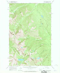
1966 Map of Howard Lake
USGS Topo · Published 1970About this map
The Cabinet Mountains define the high country of the mid-1960s, a landscape where industry and wilderness intersect across the Kootenai National Forest and Kaniksu National Forest. This era of the northwestern Rockies was characterized by significant mining activity tucked into narrow drainages, with the Midas Mine, Gloria Mine, and American Kootenai Mine serving as key markers of extraction history in Lincoln Co. The map records a complex network of pack trails, such as the Libby Teeters Peak Trail (Pack), providing the only access to the high basins and alpine lakes.
Find a feature on this map
51 named features on this map. Tap any name to fly to it.
Don’t see what you’re looking for? This feature index may not catch every label — zoom into the map to look around manually.
Map Details
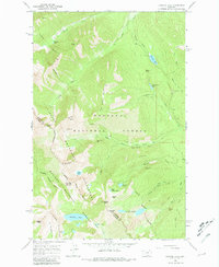
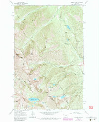
Editions of this 1966 Howard Lake Map
3 editions found
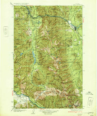
Other maps of this area

1920 · Libby
USGS Topo · 1:125,000

1920 · Jennings
USGS Topo · 1:125,000

1930 · Libby
USGS Topo · 1:125,000
1932 · Libby
USGS Topo · 1:125,000

1932 · Trout Creek
USGS Topo · 1:125,000

1935 · Thompson Lakes
USGS Topo · 1:96,000

1935 · Trout Creek
USGS Topo · 1:125,000

1936 · Trout Creek
USGS Topo · 1:125,000

1937 · Thompson Falls
USGS Topo · 1:125,000

1942 · Thompson Lakes
USGS Topo · 1:125,000