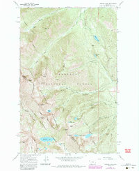
1966 Map of Howard Lake
USGS Topo · Published 1984About this map
The Cabinet Mountains define this high-elevation landscape along the boundary of the Kootenai National Forest and Kaniksu National Forest. In the mid-1960s, this area of the Lincoln and Sanders County line remained a center for mineral prospecting and backcountry travel. Numerous mining operations are documented across the slopes of Great Northern Mountain and Twin Peaks, including the American Kootenai Mine, Midas Mine, and the Gloria Mine.
Find a feature on this map
44 named features on this map. Tap any name to fly to it.
Don’t see what you’re looking for? This feature index may not catch every label — zoom into the map to look around manually.
Map Details
Editions of this 1966 Howard Lake Map
3 editions found
Other maps of this area

1920 · Libby
USGS Topo · 1:125,000

1920 · Jennings
USGS Topo · 1:125,000

1930 · Libby
USGS Topo · 1:125,000

1932 · Libby
USGS Topo · 1:125,000

1932 · Trout Creek
USGS Topo · 1:125,000

1935 · Thompson Lakes
USGS Topo · 1:96,000

1935 · Trout Creek
USGS Topo · 1:125,000

1936 · Trout Creek
USGS Topo · 1:125,000

1937 · Thompson Falls
USGS Topo · 1:125,000

1942 · Thompson Lakes
USGS Topo · 1:125,000