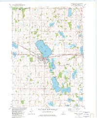
1982 Map of Howard Lake
USGS Topo · Published 1982About this map
The town of Howard Lake serves as the central hub of this Wright County landscape, positioned along the Burlington Northern railroad corridor. The area is characterized by a dense concentration of glacial lakes, including Lake Ann, Lake Emma, and Marys Lee, which dictated the early settlement patterns and transport routes. Rural life in Victor Twp and Middleville is evidenced by the numerous cemeteries and town halls that dot the countryside, such as Reinmuth Cem and St James Cem.
Find a feature on this map
49 named features on this map. Tap any name to fly to it.
Don’t see what you’re looking for? This feature index may not catch every label — zoom into the map to look around manually.
Map Details
Editions of this 1982 Howard Lake Map
This is the sole edition of this map. No revisions or reprints were ever made.
Other maps of this area

1953 · Saint Paul
USGS Topo · 1:250,000

1953 · New Ulm
USGS Topo · 1:250,000

1953 · Saint Cloud
USGS Topo · 1:250,000

1953 · Stillwater
USGS Topo · 1:250,000

1955 · Stillwater
USGS Topo · 1:250,000

1957 · Saint Cloud
USGS Topo · 1:250,000

1957 · New Ulm
USGS Topo · 1:250,000

1957 · Waconia
USGS Topo · 1:62,500

1958 · New Ulm
USGS Topo · 1:250,000

1958 · Stillwater
USGS Topo · 1:250,000