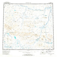
1956 Map of Howard Pass
USGS Topo · Published 1967About this map
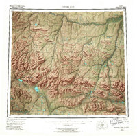
Howard Pass serves as the central crossing point in this mid-century survey of the Arctic wilderness, where the Brooks Range meets the vast drainage systems of the north. Much of the northern half of the territory is defined by the Naval Petroleum Reserve No 4, reflecting the era's strategic focus on energy resources. The landscape is a network of unnamed and named water bodies including the large Desperation Lake and Feniak Lake, which feed the southern-flowing Anisak River. To the north, the Colville River and its tributaries like Kiligwa River carve through prominent ridges such as Liberator Ridge and Monument Ridge. This map illustrates a transition between the high peaks of the De Long Mountains and the lower rolling hills, capturing a remote region through aerial photogrammetry before extensive modern modification.
Find a feature on this map
107 named features on this map. Tap any name to fly to it.
Don’t see what you’re looking for? This feature index may not catch every label — zoom into the map to look around manually.
Map Details
Editions of this 1956 Howard Pass Map
5 editions found


Other maps of this area

1951 · Baird Mountains
USGS Topo · 1:250,000

1951 · Utukok River
USGS Topo · 1:250,000

1951 · Lookout Ridge
USGS Topo · 1:250,000

1951 · Ikpikpuk River
USGS Topo · 1:250,000

1951 · Survey Pass
USGS Topo · 1:250,000

1951 · Howard Pass
USGS Topo · 1:250,000

1951 · Ambler River
USGS Topo · 1:250,000

1951 · Misheguk Mountain
USGS Topo · 1:250,000

1951 · Killik River
USGS Topo · 1:250,000

1956 · Lookout Ridge
USGS Topo · 1:250,000