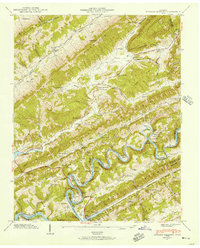
1942 Map of Howard Quarter
USGS Topo · Published 1957About this map
The Clinch River snakes through the heart of this landscape, its tight meanders carving deep bends like Lee Bend and Posey Bend as it flows toward the rising waters of the Norris Reservoir. This 1942 field examination captures the rural character of the borderlands between Claiborne, Hancock, and Grainger counties, where settlement is defined by the narrow valleys of Little Sycamore Creek and Indian Creek. Community life is anchored by a network of small country schools and churches, including Howard Quarter Sch, Caney Valley Sch, and the Seal Chapel.
Find a feature on this map
84 named features on this map. Tap any name to fly to it.
Don’t see what you’re looking for? This feature index may not catch every label — zoom into the map to look around manually.
Map Details
Editions of this 1942 Howard Quarter Map
2 editions found
Other maps of this area

1883 · Morristown
USGS Topo · 1:125,000

1886 · Cumberland Gap
USGS Topo · 1:125,000

1887 · Jonesville
USGS Topo · 1:125,000

1888 · Cumberland Gap
USGS Topo · 1:125,000

1891 · Cumberland Gap
USGS Topo · 1:125,000

1891 · Jonesville
USGS Topo · 1:125,000

1893 · Morristown
USGS Topo · 1:125,000

1895 · Morristown
USGS Topo · 1:125,000

1897 · Maynardville
USGS Topo · 1:125,000

1900 · Maynardville
USGS Topo · 1:125,000