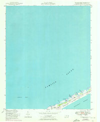
1950 Map of Howard Reef
USGS Topo · Published 1972About this map
Ocracoke Island is depicted here as a narrow, windswept thread of land separating the Atlantic Ocean from the expansive Pamlico Sound. This 1940s-era topography, updated with photorevisions in 1970, captures the shifting sands of the Cape Hatteras National Seashore before more modern development altered the shoreline profile. The map reveals a remote landscape dotted with small outposts and maritime landmarks like Cass Williams Camp and Dicks Camp, which hint at the traditional hunting and fishing culture of the Outer Banks.
Find a feature on this map
21 named features on this map. Tap any name to fly to it.
Don’t see what you’re looking for? This feature index may not catch every label — zoom into the map to look around manually.
Map Details
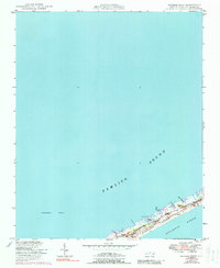
Editions of this 1950 Howard Reef Map
3 editions found
Other maps of this area

1948 · Portsmouth
USGS Topo · 1:24,000
1948 · Ocracoke
USGS Topo · 1:24,000

1950 · Howard Reef
USGS Topo · 1:24,000

1950 · Portsmouth
USGS Topo · 1:24,000
1950 · Green Island
USGS Topo · 1:24,000

1953 · Rocky Mount
USGS Topo · 1:250,000

1954 · Rocky Mount
USGS Topo · 1:250,000

1955 · Wanchese
USGS Topo · 1:250,000

1957 · Manteo
USGS Topo · 1:250,000

1960 · Manteo
USGS Topo · 1:250,000