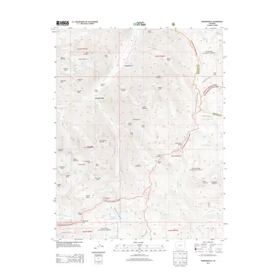
2013 Map of Howardsville
USGS Topo · Published 2013About this map
Howardsville and the nearby settlement of Middleton occupy the high-altitude valley of the Animas River, a landscape defined by the legacies of the San Juan silver boom. The presence of the Pride of the West Mill underscores the industrial history of this region, where deep gulches like Cataract Gulch and Minnie Gulch provided access to high-country mineral deposits. To the east, the Continental Divide forms a natural boundary between the Gunnison National Forest and the Rio Grande National Forest, with the Continental Divide National Scenic Trail tracing the ridge line. Water sources are abundant even at these elevations, from the Highland Mary Lakes to smaller bodies like Silver Lake and Crystal Lake. Numerous peaks including King Solomon Mountain, Galena Mountain, and Macomber Peak punctuate the horizon, illustrating the transition from river-bottom settlements to the alpine headwaters of the Rio Grande.
Find a feature on this map
80 named features on this map. Tap any name to fly to it.
Don’t see what you’re looking for? This feature index may not catch every label — zoom into the map to look around manually.
Map Details
Editions of this 2013 Howardsville Map
This is the sole edition of this map. No revisions or reprints were ever made.
Other maps of this area

1897 · Silverton
USGS Topo · 1:62,500

1900 · Needle Mountains
USGS Topo · 1:62,500

1901 · Silverton
USGS Topo · 1:62,500

1902 · Needle Mountains
USGS Topo · 1:62,500

1902 · Silverton
USGS Topo · 1:62,500

1905 · San Cristobal
USGS Topo · 1:125,000

1907 · San Cristobal
USGS Topo · 1:125,000

1945 · Durango
USGS Topo · 1:250,000

1953 · Durango
USGS Topo · 1:250,000

1954 · Durango
USGS Topo · 1:250,000