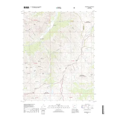
2019 Map of Howardsville
USGS Topo · Published 2019About this map
Howardsville and the nearby settlement of Middleton sit at the confluence of mountain waters where the Animas River meets tributaries like Cunningham Cr. This 2019 survey documents a landscape defined by high-altitude basins and mining-era nomenclature, such as the Arrastra Basin and Hematite Basin, reflecting a long history of mineral exploration in the San Juan Mountains. The terrain is divided by the Continental Divide, which separates the headwaters of the Rio Grande flowing east from the Animas River drainage flowing west. High alpine features including the Highland Mary Lakes, Silver Lake, and Crystal Lake are scattered among peaks like King Solomon Mtn and Galena Mtn. The map also traces modern recreational routes, most notably the Continental Divide National Scenic Trail, which winds through the San Juan National Forest and Gunnison National Forest.
Find a feature on this map
76 named features on this map. Tap any name to fly to it.
Don’t see what you’re looking for? This feature index may not catch every label — zoom into the map to look around manually.
Map Details
Editions of this 2019 Howardsville Map
This is the sole edition of this map. No revisions or reprints were ever made.
Other maps of this area

1897 · Silverton
USGS Topo · 1:62,500

1900 · Needle Mountains
USGS Topo · 1:62,500

1901 · Silverton
USGS Topo · 1:62,500

1902 · Needle Mountains
USGS Topo · 1:62,500

1902 · Silverton
USGS Topo · 1:62,500

1905 · San Cristobal
USGS Topo · 1:125,000

1907 · San Cristobal
USGS Topo · 1:125,000

1945 · Durango
USGS Topo · 1:250,000

1953 · Durango
USGS Topo · 1:250,000

1954 · Durango
USGS Topo · 1:250,000