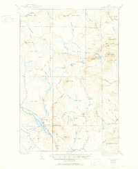
1939 Map of Howe Brook
USGS Topo · Published 1951About this map
Logging camps and remote hunting clubs dot the backcountry of Aroostook County in this mid-century survey. The southern portion of the sheet is anchored by the Bangor and Aroostook railroad, which passes through the small settlement at Howe Brook and the nearby Little Canada. The rail line parallels the Aroostook River, serving as a vital transportation artery for the region's timber and recreational economy.
Find a feature on this map
77 named features on this map. Tap any name to fly to it.
Don’t see what you’re looking for? This feature index may not catch every label — zoom into the map to look around manually.
Map Details
Editions of this 1939 Howe Brook Map
3 editions found
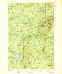
Other maps of this area

1931 · Ashland
USGS Topo · 1:48,000

1934 · Bridgewater
USGS Topo · 1:48,000

1934 · Ashland
USGS Topo · 1:62,500

1935 · Howe Brook
USGS Topo · 1:48,000

1935 · Presque Isle
USGS Topo · 1:62,500

1936 · Mars Hill
USGS Topo · 1:48,000

1937 · Smyrna Mills
USGS Topo · 1:62,500

1938 · Bridgewater
USGS Topo · 1:62,500

1938 · Houlton
USGS Topo · 1:62,500

1939 · Howe Brook
USGS Topo · 1:62,500
Featured Places
- Hammond, ME
- Howe Brook, Saint Croix Township
- Little Canada, Saint Croix Township
- Weeksboro, Dudley Township
- E Township, ME