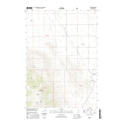
2017 Map of Howe
USGS Topo · Published 2017About this map
The settlement of Howe sits at the intersection of a vast high-desert basin and the steep eastern front of the Lost River Range. This 2017 study illustrates the rural infrastructure of the Little Lost River Valley, where the Little Lost River and its tributaries, such as Hurst Cr and Warm Spring Cr, drain toward the sinks to the south. The landscape is characterized by a sharp contrast between the irrigated valley floor and the protected wilderness of the Challis National Forest. High points like Jumpoff Peak overlook the deep incisions of Jumpoff Canyon and Horsethief Canyon, while the Howe Airport and a grid of secondary roads like W 3900 N provide essential links for this isolated ranching community. The map traces the transition from the alluvial fans of Taylor Canyon to the managed agricultural lands along the Little Lost River Hwy.
Find a feature on this map
29 named features on this map. Tap any name to fly to it.
Don’t see what you’re looking for? This feature index may not catch every label — zoom into the map to look around manually.
Map Details
Editions of this 2017 Howe Map
This is the sole edition of this map. No revisions or reprints were ever made.
Other maps of this area

1955 · Idaho Falls
USGS Topo · 1:250,000

1958 · Idaho Falls
USGS Topo · 1:250,000

1969 · Arco Pass
USGS Topo · 1:24,000

1969 · Little Lost River Sinks
USGS Topo · 1:24,000

1969 · Tyler Peak
USGS Topo · 1:24,000

1969 · Howe
USGS Topo · 1:24,000

1969 · Howe NW
USGS Topo · 1:24,000

1969 · Howe NE
USGS Topo · 1:24,000

1972 · Howe Peak
USGS Topo · 1:24,000

1972 · Arco Hills
USGS Topo · 1:24,000