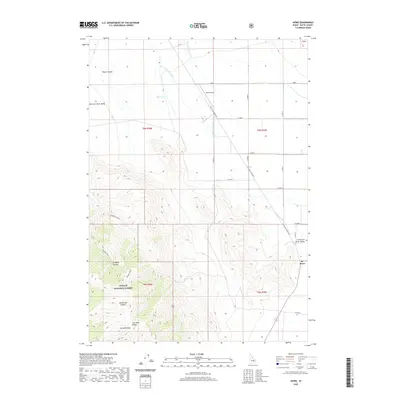
2020 Map of Howe
USGS Topo · Published 2020About this map
Howe serves as the primary settlement hub in this 2020 study of Butte County, situated where the Little Lost River Hwy transitions from the broad Little Lost River Valley into the rising elevations of the Lost River Range. The map documents a stark landscape defined by the sharp divide between irrigated valley floors and the steep terrain of the Challis National Forest. Notable topographic features such as Jumpoff Peak and Horsethief Canyon dominate the southwestern portion of the quadrangle, while the Little Lost River and its tributaries, including Warm Spring Cr and Hurst Cr, illustrate the drainage patterns essential to this high-desert region. The proximity of the Howe Airport to the town center emphasizes the importance of regional connectivity in this portion of Idaho.
Find a feature on this map
17 named features on this map. Tap any name to fly to it.
Don’t see what you’re looking for? This feature index may not catch every label — zoom into the map to look around manually.
Map Details
Editions of this 2020 Howe Map
This is the sole edition of this map. No revisions or reprints were ever made.
Other maps of this area

1955 · Idaho Falls
USGS Topo · 1:250,000

1958 · Idaho Falls
USGS Topo · 1:250,000

1969 · Arco Pass
USGS Topo · 1:24,000

1969 · Little Lost River Sinks
USGS Topo · 1:24,000

1969 · Tyler Peak
USGS Topo · 1:24,000

1969 · Howe
USGS Topo · 1:24,000

1969 · Howe NW
USGS Topo · 1:24,000

1969 · Howe NE
USGS Topo · 1:24,000

1972 · Howe Peak
USGS Topo · 1:24,000

1972 · Arco Hills
USGS Topo · 1:24,000