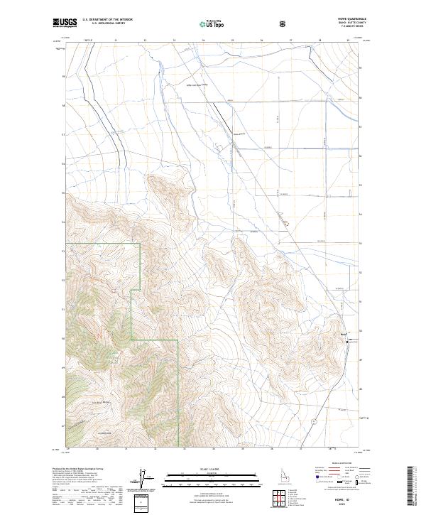
2023 Map of Howe
USGS Topo · Published 2023About this map
Howe serves as the primary settlement hub at the southern edge of the Little Lost Valley, where the high desert floor meets the rising peaks of the Lost River Range. This modern survey illustrates the persistent agricultural and ranching footprint of the region, anchored by the Little Lost River and a network of section-line roads like W 3900 N. The transition from the valley floor to the protected lands of the Challis National Forest is marked by significant topographical shifts, including the ascent toward Jumpoff Peak. Local history and geography are preserved through specific landmarks like Howe Cem and the Howe Airport, while backcountry access is traced through routes such as the Jumpoff Peak Trl and Jumpoff Canyon Trl.
Find a feature on this map
24 named features on this map. Tap any name to fly to it.
Don’t see what you’re looking for? This feature index may not catch every label — zoom into the map to look around manually.
Map Details
Editions of this 2023 Howe Map
This is the sole edition of this map. No revisions or reprints were ever made.
Other maps of this area

1955 · Idaho Falls
USGS Topo · 1:250,000

1958 · Idaho Falls
USGS Topo · 1:250,000

1969 · Arco Pass
USGS Topo · 1:24,000

1969 · Little Lost River Sinks
USGS Topo · 1:24,000

1969 · Tyler Peak
USGS Topo · 1:24,000

1969 · Howe
USGS Topo · 1:24,000

1969 · Howe NW
USGS Topo · 1:24,000

1969 · Howe NE
USGS Topo · 1:24,000

1972 · Howe Peak
USGS Topo · 1:24,000

1972 · Arco Hills
USGS Topo · 1:24,000