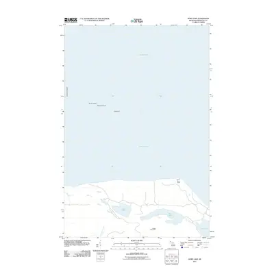
2011 Map of Howe Lake
USGS Topo · Published 2011About this map
Lake Superior dominates the northern reaches of this coastal survey, where a remote archipelago of the Huron Islands breaks the water's surface. These small landmasses, including Mcintyre Island, Gull Island, and the specifically identified Lighthouse Island, suggest a landscape historically critical for maritime navigation along the Michigan shoreline. On the mainland, the topography rises toward Huron Mountain, a significant elevation overlooking a series of inland freshwater bodies. A network of primitive roads and trails provides access to Howe Lake, Rush Lake, and Pine Lake. This specific alignment of coastal points like Huron River Point and the drainage of the Little Huron River into the great lake illustrates the natural hydrology of Marquette County in the early 21st century, showing an area primarily defined by its timbered interior and secluded water systems.
Find a feature on this map
12 named features on this map. Tap any name to fly to it.
Don’t see what you’re looking for? This feature index may not catch every label — zoom into the map to look around manually.
Map Details
Editions of this 2011 Howe Lake Map
This is the sole edition of this map. No revisions or reprints were ever made.
Other maps of this area

1954 · Huron Mountain
USGS Topo · 1:62,500

1954 · Skanee
USGS Topo · 1:62,500

1958 · Hancock
USGS Topo · 1:250,000

1958 · Marquette
USGS Topo · 1:250,000

1958 · Iron River
USGS Topo · 1:250,000

1960 · Iron River
USGS Topo · 1:250,000

1960 · Hancock
USGS Topo · 1:250,000

1960 · Marquette
USGS Topo · 1:250,000

1961 · Marquette
USGS Topo · 1:250,000

1961 · Iron River
USGS Topo · 1:250,000