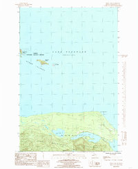
1984 Map of Howe Lake
USGS Topo · Published 1985About this map
Lighthouse Island and its storied Huron Island L.H. anchor this maritime landscape along the southern coast of Lake Superior in the mid-1980s. This portion of the Huron National Wildlife Refuge includes a cluster of rocky outcroppings like McIntyre Island and Gull Island, providing a detailed look at the navigational hazards and safety measures of the Upper Peninsula shoreline. On the mainland, the Huron Mountains rise sharply from the water, characterized by high-elevation peaks such as Mount Ida. The interior is defined by a dense network of freshwater bodies, including Howe Lake and the interconnected Rush Lake. Evidence of local resource extraction is found at the Gravel Sand Pit near Huron River Point, showing the modest industrial footprint within this largely protected wilderness area.
Find a feature on this map
18 named features on this map. Tap any name to fly to it.
Don’t see what you’re looking for? This feature index may not catch every label — zoom into the map to look around manually.
Map Details
Editions of this 1984 Howe Lake Map
This is the sole edition of this map. No revisions or reprints were ever made.
Other maps of this area

1954 · Huron Mountain
USGS Topo · 1:62,500

1954 · Skanee
USGS Topo · 1:62,500

1958 · Hancock
USGS Topo · 1:250,000

1958 · Marquette
USGS Topo · 1:250,000

1958 · Iron River
USGS Topo · 1:250,000

1960 · Iron River
USGS Topo · 1:250,000

1960 · Hancock
USGS Topo · 1:250,000

1960 · Marquette
USGS Topo · 1:250,000

1961 · Marquette
USGS Topo · 1:250,000

1961 · Iron River
USGS Topo · 1:250,000